
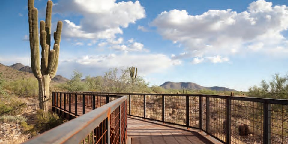
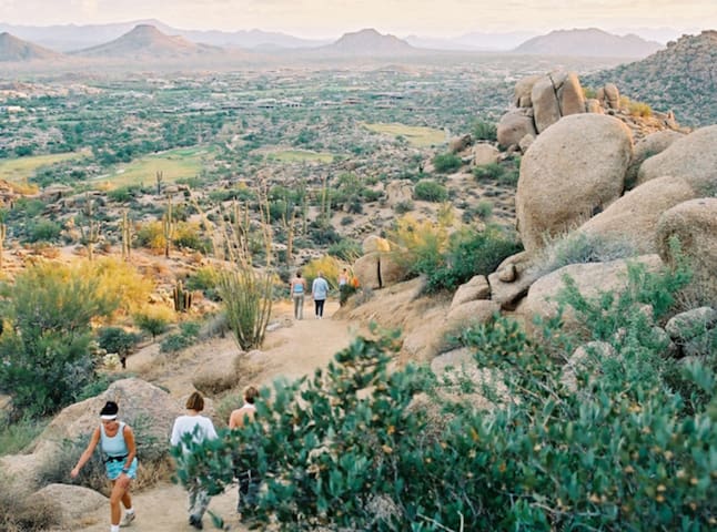
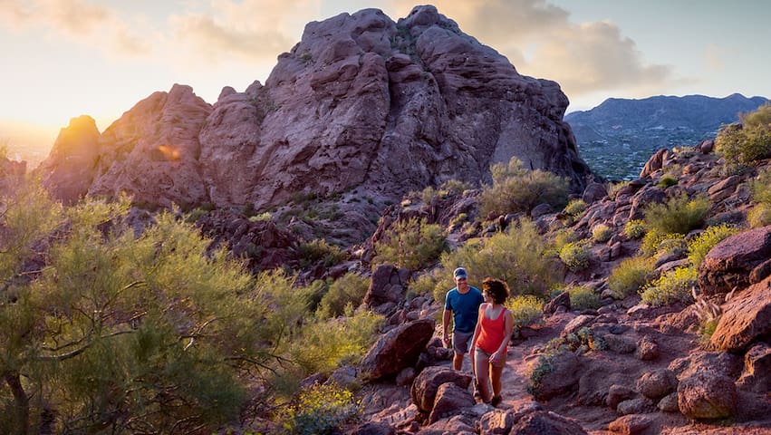
AREA HIKING
Hiking
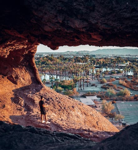
Double Butte Loop and Hole-in-the-Rock Trail in Papago Park
Distance: 2.3-mile loop (Double Butte) and 825 feet out and back (Hole-in-the-Rock)
What better way to ogle the uncanny red sandstone formations of Papago Park than hiking around (and inside) them? The smaller two of these beautiful buttes can be explored on an easy dirt loop that starts in the West Park parking lot, accessible from Galvin Parkway. Then, drive across the street to the park’s east side for a quick climb up rocky stairs to peek out from the cave-like Hole-in-the-Rock, a popular landmark (and prehistoric solstice-tracking tool) with views of an oasis and distant city skyline.
184 Recomendado por los habitantes de la zona
Agujero en la Roca
625 N Galvin PkwyDouble Butte Loop and Hole-in-the-Rock Trail in Papago Park
Distance: 2.3-mile loop (Double Butte) and 825 feet out and back (Hole-in-the-Rock)
What better way to ogle the uncanny red sandstone formations of Papago Park than hiking around (and inside) them? The smaller two of these beautiful buttes can be explored on an easy dirt loop that starts in the West Park parking lot, accessible from Galvin Parkway. Then, drive across the street to the park’s east side for a quick climb up rocky stairs to peek out from the cave-like Hole-in-the-Rock, a popular landmark (and prehistoric solstice-tracking tool) with views of an oasis and distant city skyline.
Blevins Trail in Usery Mountain Regional Park
Distance: 3-mile loop
For an easygoing introduction to quintessential Sonoran Desert scenery, this trail is your pick. The flat, meandering path lets you take your eyes off your footing to scope out towering saguaros, tangled ocotillos, bristling bushes of cholla and the banded ridgeline of nearby Pass Mountain.
Blevins Trail
Blevins TrailBlevins Trail in Usery Mountain Regional Park
Distance: 3-mile loop
For an easygoing introduction to quintessential Sonoran Desert scenery, this trail is your pick. The flat, meandering path lets you take your eyes off your footing to scope out towering saguaros, tangled ocotillos, bristling bushes of cholla and the banded ridgeline of nearby Pass Mountain.
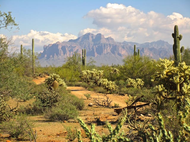
Waterfall Trail in White Tank Mountain Regional Park
Distance: 1.8 miles out and back
Saguaros, ancient petroglyph carvings, wide paths and rocky outcroppings along this easy trail provide a slice of Sonoran Desert beauty without tricky footing or much elevation gain. Sighting the namesake waterfall at the end of the trail is rare, but possible if you come after a rain. Park entrance is $6.
108 Recomendado por los habitantes de la zona
Parque Regional White Tank Mountain
Waterfall Trail in White Tank Mountain Regional Park
Distance: 1.8 miles out and back
Saguaros, ancient petroglyph carvings, wide paths and rocky outcroppings along this easy trail provide a slice of Sonoran Desert beauty without tricky footing or much elevation gain. Sighting the namesake waterfall at the end of the trail is rare, but possible if you come after a rain. Park entrance is $6.
Hidden Valley via Mormon Trail in South Mountain Park/Preserve
Distance: 4 miles out and back
This steep trail leans toward the more difficult side of a moderate hike, but if you’re up for the challenge, it’s a must-see for views, desert flora and fun rock formations. Start at the Mormon Trailhead and connect with the National Trail to head south. That was the hard part: The remainder of the hike is for peeking at petroglyphs, playing around a natural tunnel and tight squeeze through “Fat Man’s Pass.” The lollipop-shaped loop brings you back to Mormon Trail for your descent.
29 Recomendado por los habitantes de la zona
Punto de partida del Sendero Mormón
8610 South 24th StreetHidden Valley via Mormon Trail in South Mountain Park/Preserve
Distance: 4 miles out and back
This steep trail leans toward the more difficult side of a moderate hike, but if you’re up for the challenge, it’s a must-see for views, desert flora and fun rock formations. Start at the Mormon Trailhead and connect with the National Trail to head south. That was the hard part: The remainder of the hike is for peeking at petroglyphs, playing around a natural tunnel and tight squeeze through “Fat Man’s Pass.” The lollipop-shaped loop brings you back to Mormon Trail for your descent.
Pinnacle Peak Trail in Pinnacle Peak Park
Distance: 3.5 miles out and back
A groomed pathway provides easy footing for soaking up the scenic views, spotting wildlife and greeting passerby—it’s a popular trail, and not without reason. The incline to 2,750 feet is gradual and well-maintained, and while you won’t be able to clamber on the true “pinnacle” of granite at the top, the trail still offers raw panoramic views of the desert unfolding below.
39 Recomendado por los habitantes de la zona
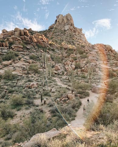
Pinnacle Peak Park Main Trail
Pinnacle Peak Park Main TrailPinnacle Peak Trail in Pinnacle Peak Park
Distance: 3.5 miles out and back
A groomed pathway provides easy footing for soaking up the scenic views, spotting wildlife and greeting passerby—it’s a popular trail, and not without reason. The incline to 2,750 feet is gradual and well-maintained, and while you won’t be able to clamber on the true “pinnacle” of granite at the top, the trail still offers raw panoramic views of the desert unfolding below.
Lookout Mountain Summit Trail in Phoenix Mountains Preserve
Distance: 1.2 miles out and back
In just under a mile on this short trail, you’ll climb more than 450 feet, but the burst of breathlessness is worth the views up top. The summit looks out south over the Phoenix Mountains Preserve, and is a less crowded and more moderate hike than popular summits of Camelback and Piestewa (see the “hard” section for details on these). The trailhead is accessible from 16th street. If you’d like to continue your hike, join up with the Circumference Trail that runs a 2.6-mile route through the rocky desert at the mountain’s feet.
78 Recomendado por los habitantes de la zona

Reserva Natural Phoenix Mountain
2701 Piestewa Peak DriveLookout Mountain Summit Trail in Phoenix Mountains Preserve
Distance: 1.2 miles out and back
In just under a mile on this short trail, you’ll climb more than 450 feet, but the burst of breathlessness is worth the views up top. The summit looks out south over the Phoenix Mountains Preserve, and is a less crowded and more moderate hike than popular summits of Camelback and Piestewa (see the “hard” section for details on these). The trailhead is accessible from 16th street. If you’d like to continue your hike, join up with the Circumference Trail that runs a 2.6-mile route through the rocky desert at the mountain’s feet.
Dixie Mountain Loop in the Phoenix Sonoran Preserve
Distance: 3.82-mile loop
Start out through thick hills of saguaros, end in a lush riparian area. It's possible on this one short hike, which begins on the Maricopa Trail and angles across a plateau into Jewel of the Creek Preserve. The refreshing riparian habitat is filled with colorful creek-side cottonwoods and willows. Head back up Spur Cross Road to reconnect with the starting point.
27 Recomendado por los habitantes de la zona
Reserva Natural del Desierto de Sonora de Phoenix
1600 East Sonoran Desert DriveDixie Mountain Loop in the Phoenix Sonoran Preserve
Distance: 3.82-mile loop
Start out through thick hills of saguaros, end in a lush riparian area. It's possible on this one short hike, which begins on the Maricopa Trail and angles across a plateau into Jewel of the Creek Preserve. The refreshing riparian habitat is filled with colorful creek-side cottonwoods and willows. Head back up Spur Cross Road to reconnect with the starting point.
Tom's Thumb, Feldspar, Mesquite Canyon Loop
Distance: 1.1 mile loop
Feldspar is one of the three minerals that make up the granite boulders prominent in this area of the Preserve, which winds along the northern slope of the McDowell Mountains. This easy hike also provides dramatic views of Mesquite Canyon.
41 Recomendado por los habitantes de la zona
Toms Thumb
Tom's Thumb TrailTom's Thumb, Feldspar, Mesquite Canyon Loop
Distance: 1.1 mile loop
Feldspar is one of the three minerals that make up the granite boulders prominent in this area of the Preserve, which winds along the northern slope of the McDowell Mountains. This easy hike also provides dramatic views of Mesquite Canyon.
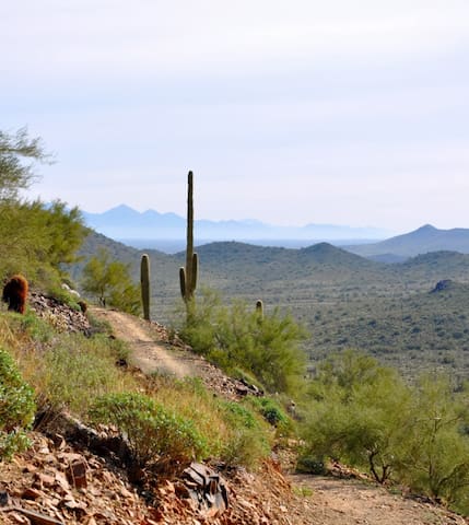
Lost Dog Wash Trail to Taliesin Overlook
Distance: 4.8 miles out-and-back
On this hike, you’ll parallel the Lost Dog Wash as it spills out of the McDowell Mountains. Your goal is the Taliesin Overlook, here you’ll enjoy scenic views of north Scottsdale and Phoenix to the west. You’ll also catch a distant glimpse of Frank Lloyd Wright’s desert masterpiece, Taliesin West, from the overlook.
70 Recomendado por los habitantes de la zona
Lost Dog Wash Trailhead
12601 N 124th StLost Dog Wash Trail to Taliesin Overlook
Distance: 4.8 miles out-and-back
On this hike, you’ll parallel the Lost Dog Wash as it spills out of the McDowell Mountains. Your goal is the Taliesin Overlook, here you’ll enjoy scenic views of north Scottsdale and Phoenix to the west. You’ll also catch a distant glimpse of Frank Lloyd Wright’s desert masterpiece, Taliesin West, from the overlook.
Gateway Loop
Distance. 4.5 mile loop
One of the most popular trails in the Preserve, the Gateway Loop gives you the feeling of being immersed in the serenity of the Sonoran Desert while providing a great fitness opportunity. The trail passes over the Gateway Saddle, from which you’ll
enjoy expansive scenic views of the surrounding landscape. Bump up your pace if you’d like to get a good workout while enjoying the views.
19 Recomendado por los habitantes de la zona
Gateway Loop Trail
Gateway Loop TrailGateway Loop
Distance. 4.5 mile loop
One of the most popular trails in the Preserve, the Gateway Loop gives you the feeling of being immersed in the serenity of the Sonoran Desert while providing a great fitness opportunity. The trail passes over the Gateway Saddle, from which you’ll
enjoy expansive scenic views of the surrounding landscape. Bump up your pace if you’d like to get a good workout while enjoying the views.
Brown's Mountain Loop
Distance: 3.9 mile out and back
From the summit of Brown’s Mountain, you’ll enjoy a 360-degree view of the beautiful upper Sonoran Desert. To the north you’ll see remnants of Brown’s Ranch, which was a working cattle ranch from the early 1900s through the 1970s.
38 Recomendado por los habitantes de la zona
Brown's Ranch Trailhead
30301 N Alma School PkwyBrown's Mountain Loop
Distance: 3.9 mile out and back
From the summit of Brown’s Mountain, you’ll enjoy a 360-degree view of the beautiful upper Sonoran Desert. To the north you’ll see remnants of Brown’s Ranch, which was a working cattle ranch from the early 1900s through the 1970s.
Camelback Mountain, Cholla Trail
Distance: 3.1 miles out and back
A wildly popular urban hike near Paradise Valley, Cholla Trail is one half of the trail system traversing Camelback Mountain in Scottsdale. Start at Cholla Trailhead and spend the first half mile climbing switchbacks until the trail intersects the climbing portion of the trail. The remainder of the hike is a steep scramble up Cholla Ridge. The trail is easy to lose at times, but trail markers are strategically placed along the way. Very limited street parking.
116 Recomendado por los habitantes de la zona
Cholla Trailhead Camelback Mountain
5150 E Cholla LnCamelback Mountain, Cholla Trail
Distance: 3.1 miles out and back
A wildly popular urban hike near Paradise Valley, Cholla Trail is one half of the trail system traversing Camelback Mountain in Scottsdale. Start at Cholla Trailhead and spend the first half mile climbing switchbacks until the trail intersects the climbing portion of the trail. The remainder of the hike is a steep scramble up Cholla Ridge. The trail is easy to lose at times, but trail markers are strategically placed along the way. Very limited street parking.